
Pet & Livestock Recovery
Use Thermal Drones to Find Your Animals
Bring Home Your Missing Animals
When an animal goes missing, every minute matters. Our skilled pilots and advanced thermal drones provide rapid aerial searches that can scan large areas in minutes, even after dark or in difficult terrain. Whether it’s a family pet or valuable livestock, we use cutting-edge technology to help bring these animals home safely and reduce losses for owners and ranchers.
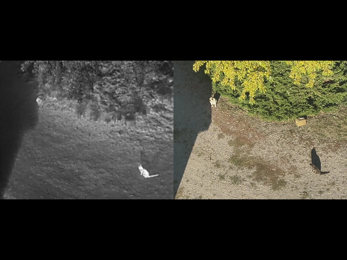
Helping Pet Owners
When a pet goes missing, speed is critical. Thermal drones can scan large areas in minutes, detecting a pet’s heat signature even in the dark or through brush and tall grass. This allows us to locate lost dogs and cats faster and more effectively than traditional ground searches, giving you peace of mind and increasing the chances of a safe recovery.
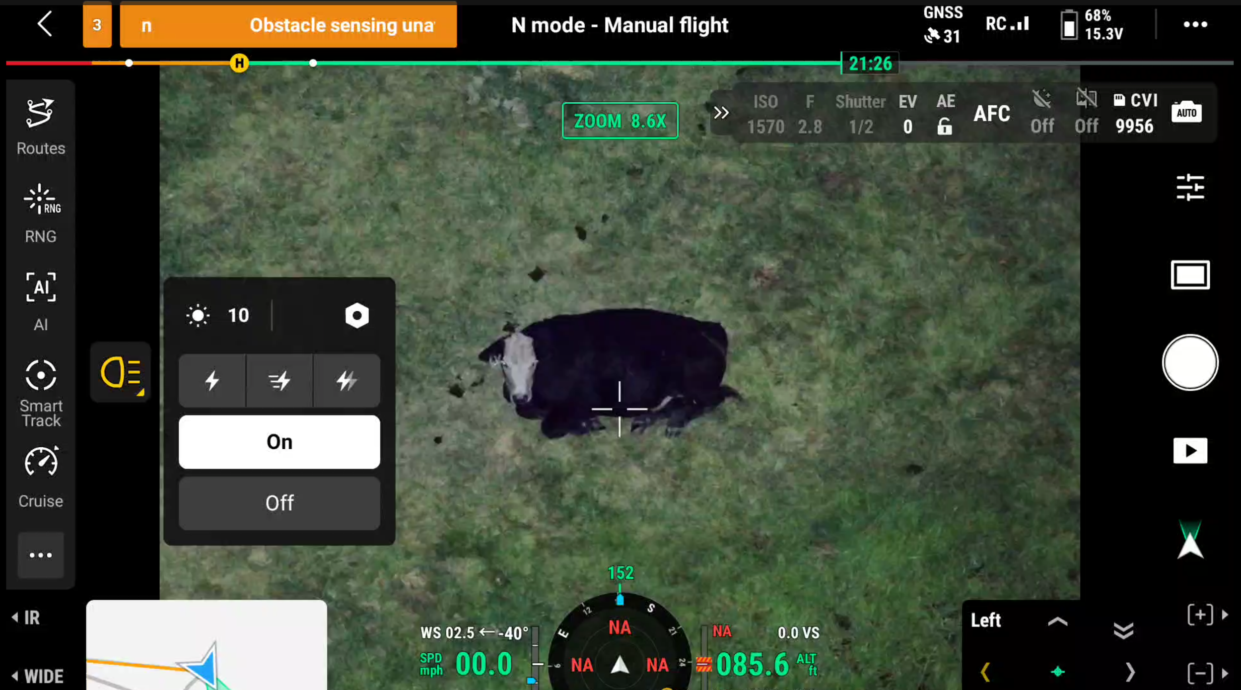
Helping Livestock Owners
Locating stray cattle or horses doesn’t have to take hours on horseback or ATVs. Our thermal drones can quickly identify livestock across wide pastures, rugged terrain, or heavy cover—day or night. Whether recovering a stray or assisting in a roundup, drones provide ranchers with an efficient, low-stress solution that saves time, reduces losses, and protects valuable animals.
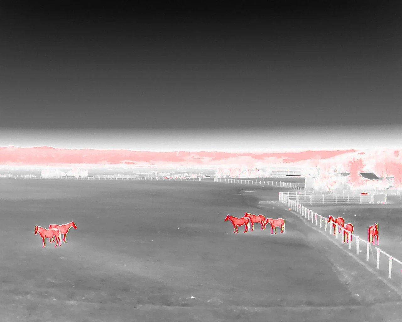
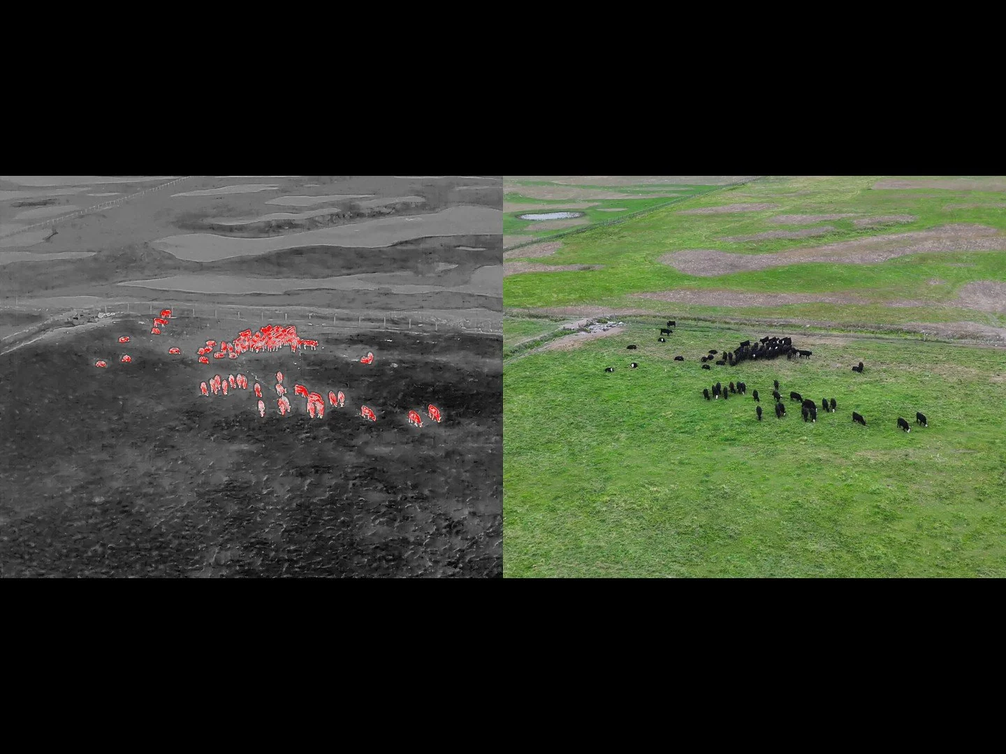
Understanding the Limits of Thermal Drones
While thermal drones are a powerful tool for locating lost animals, they are not a guarantee. Success depends on factors like weather, terrain, animal movement, and how quickly a search begins. In hot daytime conditions, dense cover, or when too much time has passed, thermal imaging may be less effective. We believe in being transparent with our clients—drones can greatly improve recovery chances in the right situations, but they are just one tool among many.
Factors That Increase Success
Fast Response Time - starting searches sooner limits the distance an animal can travel
Weather - cool, cloudy weather or snow covered ground improves thermal contrast, making animals easier to see
Time of Day - if the weather isn’t cool & cloudy, then early morning and overnight searches work best for finding thermal signatures, however a day-time visual search (non-thermal) can still be effective if in open terrain
Animal Size - larger animals like medium to large sized dogs, cattle and horses are easier to spot; although if the conditions are right and the animals are in the open, even small animals can still be very easy to spot
Animal Behavior - some animals are more likely to stick close to home or are more likely to stay moving out in the open where they are easier to see
Known Locations - providing a last known location helps establish a search area
Terrain - open terrain like pastures, hillsides, or sparse woods make it easier to see to the ground
Access - having permission to search the area without restrictions
Competing Heat Sources - less competing heat signatures in the area such as livestock, pets, wildlife and animal sized rocks helps to isolate the animal being searched for (rocks that have been in the sun retain heat for a long time)
Rural Areas - open landscapes with minimal private residences provide far less obstacles and are much easier to access and search.
Factors That Decrease Success
Slow Response Time - starting searches later can increase the distance an animal can travel
Weather - hot, humid weather decreases thermal contrast, making animals much harder to see; bad weather such as rain, snow or fog prevents flight operations
Time of Day - unless the weather is cool & cloudy, then day time searches make it very hard to find specific heat signatures, however a day-time “visual” (non-thermal) search can still be effective if in open terrain
Animal Size - smaller animals like small dogs and cats can be harder to spot; although if the conditions are right and the animals are in the open, even small animals can still be very easy to spot
Animal Behavior - some animals are more likely to roam far outside of the search area or hide underneath objects or indoors, making any thermal signatures unobservable
Known Locations - not knowing a last known location makes it hard to establish an effective search area
Terrain - dense forest canopies and heavy brush make it harder to see to the ground
Access - not having permission to search nearby areas limits the search area
Competing Heat Sources - more competing heat signatures in the area such as livestock, pets, wildlife and animal sized rocks makes it harder to isolate the animal being searched for (rocks that have been in the sun retain heat for a long time)
Urban Areas - Unfortunately we do not search over private neighborhoods and residences for privacy reasons.
How much does it cost?
Providing drone recovery requires specialized equipment, licensed & insured pilots, careful planning, travel, and field time. Charging for this service ensures we can maintain high-quality gear, cover operating costs, and continue offering reliable recovery support to pet owners and ranchers when they need it most.
Prices And Descriptions of Services
2-Hour Flight Block – $350
This is the flat search fee and includes up to 2 hours of “in-the-air” search time.
4-Hour Flight Block – $500
For larger planned operations like livestock roundups, this can be booked from the beginning or rolled over once the 2-Hour flight block has concluded.
8-Hour Flight Block – $900
For larger planned operations like livestock roundups, this can be booked from the beginning or rolled over once the 4-Hour flight block has concluded.
Lodging Rate – $125/night
If the search is extended to an additional day and the search site is farther than 60 miles from Missoula, the lodging rate is charged to cover accommodation costs.
Travel Rate – $2 per mile
Distance from Missoula to the search location, with the first 25 miles FREE. This rate is included in your booking deposit. If your animal is found before our arrival, let us know immediately and we will issue a prorated refund for the untraveled portion of the trip. Any additional travel accrued during extended searches will be included in the final invoice.
Remote Access Fee – $50 (minimum) up to $ 250 (maximum)
Required if the drone can’t be flown from the pilot's vehicle. We must remain within visual line of sight of the drone which is not always possible from the road, depending on terrain. The search equipment is heavy and fragile, making off road travel more difficult. Minimum charge is $50 to leave the vehicle, with a maximum of $250 and 2 miles from the vehicle. The fee depends on distance, elevation gain, terrain, ground cover, snow cover, etc. and will be assessed after arriving at location and included in the final invoice.
What to Expect
The phases below describe how we transition from your initial request to active field operations, and what we need from you to get us dispatched to your search area as soon as possible.
Phase 1: Complete the Initial Questionnaire
To get started we send you a short questionnaire to collect important information for mission planning.
Contact Info: Provide your email address and phone number so we can initiate the process and keep you updated.
Relevant Info: This is where you share last known location, animal type, behavior, terrain, etc.
Mission Scoping: This data allows us to instantly calculate estimated flight times and identify specific thermal challenges at the site.
Phase 2: Sign Service Agreement & Pay Deposit
Once your questionnaire is submitted, we route the necessary paperwork directly to your inbox. Securing the deposit and agreement locks your flight block into our schedule and triggers immediate pilot dispatch.
Read and Sign Service Agreement: We send a secure Adobe document directly to the email provided in Step 1 for instant digital signature.
Liability & Terms Clearance: The agreement outlines clear operational boundaries, property permissions, and all other terms.
Pay Deposit: We will also email you an invoice for an initial $100 deposit plus any additional travel rate. This must be paid before we dispatch a pilot to the search area.
Phase 3: Mission Planning & Dispatch
Before we depart, we utilize satellite mapping tools & localized weather forecasts alongside the information you provided in the intake questionnaire in order to plan the best possible search plan for the situation. With the digital planning complete, the pilot loads the specialized thermal equipment and mobilizes immediately.
Satellite Grid Mapping: We program exact boundaries and search grids directly into our flight software based on your last known location.
Topography Study: We evaluate local terrain and road access to plan takeoff & landing zones.
Airspace & Weather Clearance: We check federal airspace restrictions and real-time wind and temperature metrics to ensure safe, legal flight conditions.
Gear Preparation: We pack and secure heavy, fragile thermal sensing drones, backup power stations, monitors for viewing the live thermal feed, headlamps and handheld radios (to coordinate with you and any other ground searchers).
Travel Notification: We notify you upon departure and keep you updated via text or phone on any changes to ETA. If cell service allows, we try to notify when we are between 15 & 30 minutes from the meeting location.
Phase 4: Initial Contact & Mission Brief
Upon arrival, the pilot meets with you for a quick mission brief before putting the drone in the air. This on-site huddle ensures our digital maps are accurate and we have a solid plan in place.
Terrain & Hazard Verification: We assess real-time factors like wind, power lines, and immediate ground hazards.
Sighting & Search Update: We confirm if there have been any new tracking signs or foot/vehicle traffic since your questionnaire was submitted.
Radio Communication: The group establishes a communication plan using handheld radios or mobile phones to ensure all search team members can stay informed in real time.
Phase 5: Active Search
The pilot launches the aircraft to begin active, systematic scanning. We deploy commercial-grade thermal sensors to detect heat signatures invisible to the naked eye, cutting through dense brush and dark conditions.
Methodical Gridding: We fly automated and manual patterns across the search site, ensuring zero gaps in the area searched.
Live Feed Viewing: Often times you will already be engaged in your own ground search, however you are always welcome to watch a secondary high-resolution monitor to view the live thermal feed while the pilot is flying. However, for best search results, minimal engagement with the pilot is advised.
Systematic Territory Clearance: If the animal is not found immediately, we methodically eliminate sectors, narrowing down where they could be hiding.
Phase 6: If Located…
Whether the animal is spotted or territory is systematically ruled out, we provide you with clean, actionable data to guide your search and recovery.
GPS Coordination: If located, we provide real-time GPS coordinates and visual confirmation of your animal.
Guidance to Location: Using the drone alongside radios and/or mobile phones, we can help guide you and keep you updated while you approach on the ground.
Recovery Evaluation: We scan the surrounding terrain from the air to spot obstacles or hidden hazards, helping you plan a safe physical approach without spooking the animal.
Grid Elimination Log: If the animal is not found within the booked timeframe, we hand over the flight logs so you can confidently cross those specific grids off your list and focus ground efforts elsewhere.
Phase 7: Final Invoice & Mission Closeout
Once field operations conclude, we wrap up the administrative side of the mission. We calculate any variable on-site adjustments and deliver your final invoice directly to your inbox.
Transparent Adjustments: Any accrued mileage past the initial deposit or assessed Remote Access Fees are compiled cleanly on the invoice.
Digital Media Delivery: Your finalized invoice is sent to the email provided in Step 1, alongside any requested aerial maps or grid elimination logs.
Flexible Payment of Balance: Balances are due upon receipt of the final invoice and can be paid securely online via the digital invoice with card, Venmo, PayPal, or e-Check. They can also be settled directly on-site with the pilot using cash, Venmo or PayPal.